Your partner for high-level spatial datacapturing and analysis
AHM – AirborneMapping
AHM is your cooperation partner for high-level spatial datacapturing and analysis. We focused on customer dedicated analysis and development of soft- and hardware solutions, mainly covering the fields of environmental needs and their further processing.
Airborne Mapping
Hydro Mapping
Nature Mapping
Land Mapping
Ice & Snow Mapping
HydroVISH
A fast, powerful, and highly flexible software with a solid C++ core for advanced data visualization and processing.

KomVISH
An independently running software with which large laser scan data can be displayed in real-time. Simple interfaces to geoinformation systems allow a fast exchange of lines and polygon courses. The direct laser data can be transferred in GIS in sections.
News
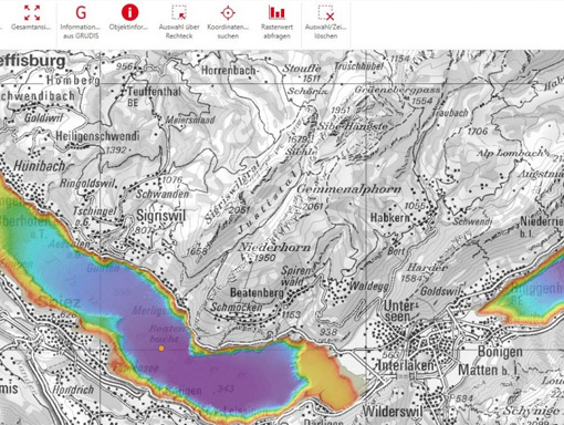
Topobathymetry of Lakes Thun and Brienz published online
33rd Nordic Geological Winter Meeting
